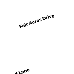
41 CAPE COD LANE
Owner Information
JOUBERT MARY E & LARRY
41 CAPE COD LANE
HANOVER, MA 02339


Property Details
41 CAPE COD LANE is classified as a Single Family Residential (Raised ranch).
The primary structure on this property was built in 1968. There are 2,172ft2 of built area within this property. There is 1,148ft2 of residential/living space within this property. This property is listed as having 6 rooms.
41 CAPE COD LANE is valued at $435,600. The land is valued at $244,900 and the structures are valued at $189,200. There is an additional valuation of $1,500 on this property.
The most recent deed for 41 CAPE COD LANE is recorded at the local registrar in Book 15603, Page 33. 41 CAPE COD LANE was last sold on Thursday, October 30, 1997 for $172,000.
Assessment data from fiscal year 2022.
Flood Data
According to the FEMA National Flood Hazard Layer, this property does not appear to be in a flood zone. It may also be in an area not yet reviewed. Nonetheless, confirm this information prior to taking any action.
To view the flood hazards around this property, create a FEMA "Firmette" Map of the area around 41 CAPE COD LANE.
Broadband Internet Providers
| Provider | Type | Bandwidth (mbps) | |
|---|---|---|---|
| Comcast | Cable | 1000 | 35 |
| Viasat Inc | Satellite | 100 | 3 |
| Verizon New England Inc. | Fiber | 940 | 880 |
| GCI Communication Corp. | Satellite | 0 | 0 |
| HughesNet | Satellite | 25 | 3 |
| VSAT Systems, LLC. | Satellite | 2 | 1 |
Broadband service provider data from December 2020.
Adjacent Properties
- 120 FAIR ACRES DRIVE
Single Family Residential owned by THOMPSON WILLIAM G & MARY E - 130 FAIR ACRES DRIVE
Single Family Residential owned by YANOVITCH ROBERT A & KAREN P - 31 CAPE COD LANE
Single Family Residential owned by HAIDUL JOSEPH B & SUSAN J - 53 CAPE COD LANE
Single Family Residential owned by CASONI, ANDREW J AND KAYLENE M